Home › Forums › MEETS & EVENTS › Nipissing Colonization Road › Reply To: Nipissing Colonization Road
I made this trip long time ago, posted it on overlandcanada.com, but couldn’t find site to post the link. But I found my post on my hard drive, so here it is. It was my first overland trip, now when I have more experience and better equipped I would probably go further and would be more confident going on trails : ) Anyway, this is original report as I saw it at that time.
We have returned from the trip on Sunday night and although it didn’t go exactly as planned it was definitely a good trip completely worth going. Forum seem to have not that much traffic so I’m posting a big report : ) If you want to skip right to the pictures I put them here: http://eseliv.byethost7.com/nr/
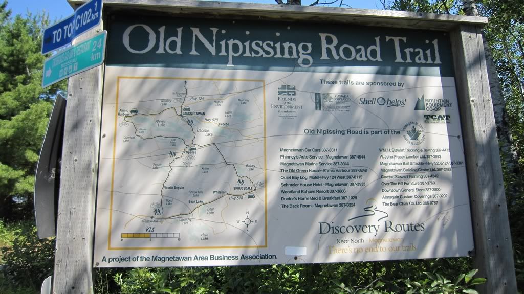
Our trip plan was to leave home Friday night, spend a night in a motel and then start going up to Nipissing Road using directions from http://www.nipissingroad.ca . I was going to order a road map from the website, but Postal strike kept me from it and I used maps found on the Internet in conjunction with Backroads map. On the route we were going to make a detour to see Screaming Heads and have lunch and few swims on Eagle Lake. I found the map here:
http://images.ourontario.ca/Almaguin/68642/image/161215
which showed that there are few public beaches and place for a picnic. After we reach the end of Nipissing Road we were going to drive to campsite and spend a night there. Our friends booked a site for us in private camping near McKellar and they were waiting for us there. So I figured that we need about 5-6 hrs for the 136km trip if we start from Rosseau at 10am and reach Nipissing at about 6pm we’ll have plenty time to drive to camping and put on a tent before it gets dark.
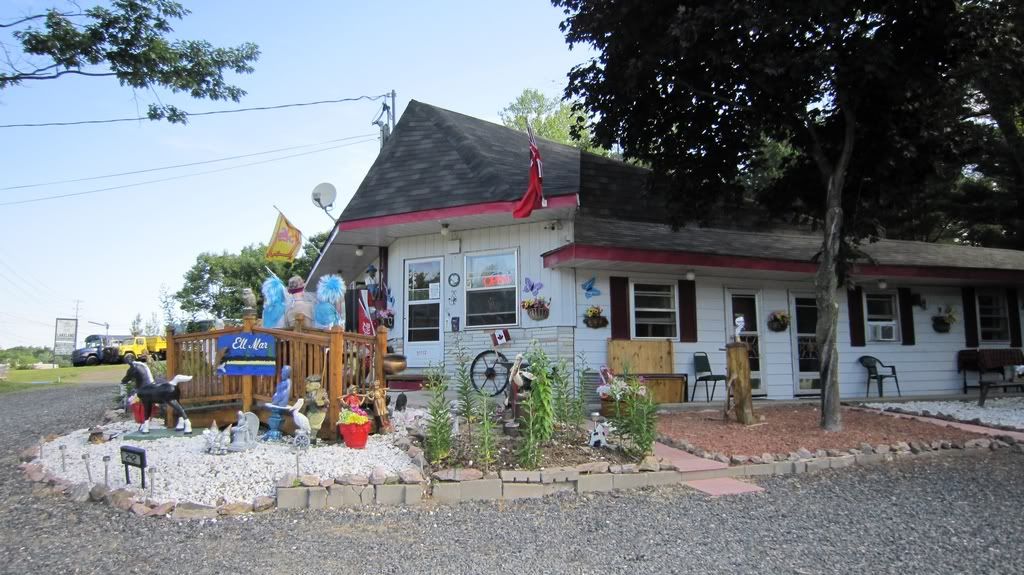
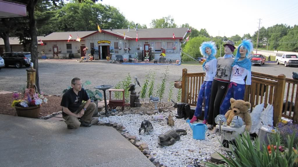
So we left home on Friday night as per our plan and drove straight to Ell-Mar Motor Inn. This was the only motel in area I could find under $100 a night on weekend. It gets quite busy on weekends and I recommend to call and book a room in advance. Ell-Mar Motor Inn appeared to be a very nice and friendly place, it’s a shame it doesn’t have a website.
http://i397.photobucket.com/albums/pp53/scanner_d/Nipissing%20Road/NR-002.jpg
http://i397.photobucket.com/albums/pp53/scanner_d/Nipissing%20Road/NR-004.jpg
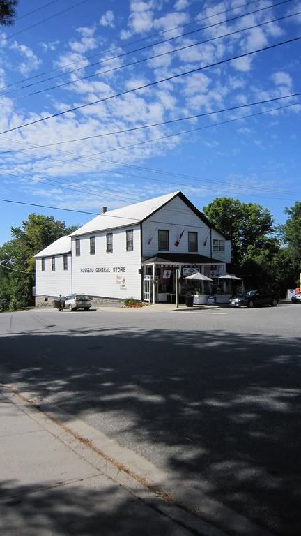
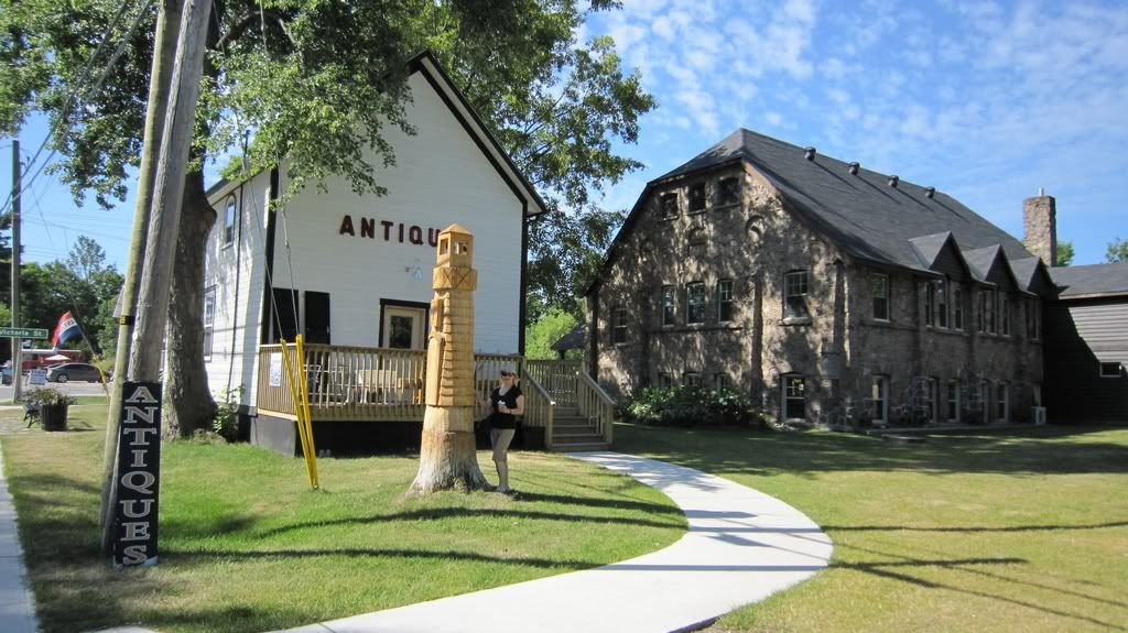
Next morning we were off for Rosseau and start of our adventure. I fuelled up in Rosseau and we took a walk around the town.
http://i397.photobucket.com/albums/pp53/scanner_d/Nipissing%20Road/NR-012.jpg
Rosseau appeared to be a small charming town with few buildings looking quite old. It has General Store built in 1874.
http://i397.photobucket.com/albums/pp53/scanner_d/Nipissing%20Road/NR-011.jpg
http://i397.photobucket.com/albums/pp53/scanner_d/Nipissing%20Road/NR-010.jpg
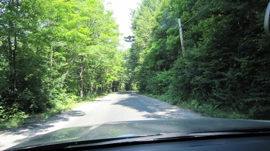
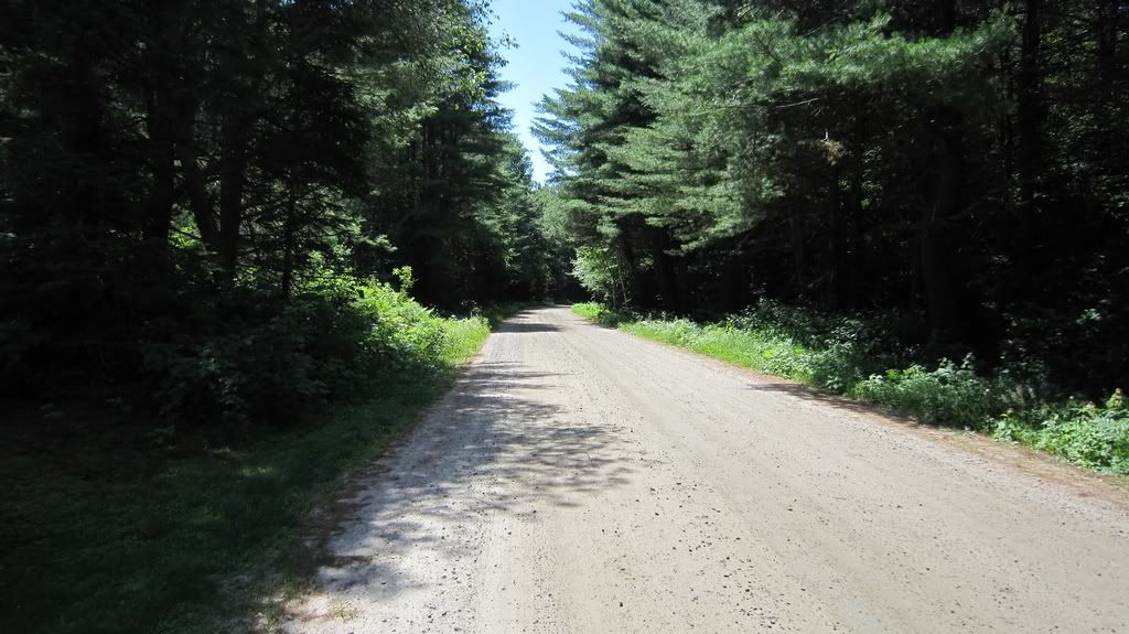
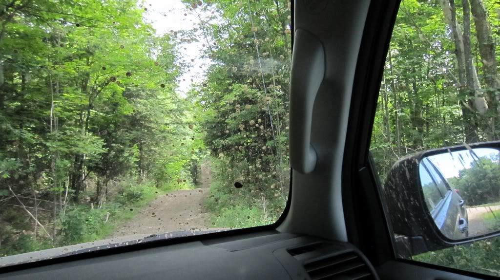
We left Rosseau and went to the Nipissing Road. In a couple of minutes we turned right on Nipissing Road and I made a picture right away.
http://i397.photobucket.com/albums/pp53/scanner_d/Nipissing%20Road/NR-013.jpg
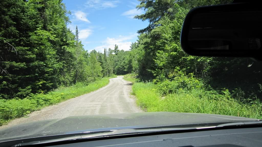
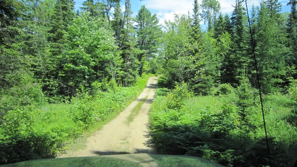
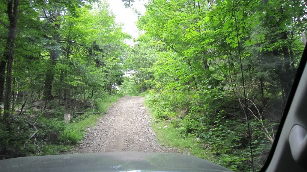
Adventure is on : ) The road I was dreaming about for long time and spent hours of looking for information and planning the trip is finally right here. I was really exited. As expected so far, wide gravel road completely dry.
http://i397.photobucket.com/albums/pp53/scanner_d/Nipissing%20Road/NR-014.jpg
Later when we got back home I found out that my Garmin GPS is taking GPX logs when it’s on. So now I can see full route we took with distances, time and speed.
After about 1 km as per http://www.nipissingroad.ca we found fork and turned right because we wanted to find original Nipissing Road and there supposed to be small church. We drove quite long (but it was only 2 km as gpx track showed us later) and all we saw were private houses or cottages which looked quite busy with life. So I thought that I either missed original Nipissing road or it’s really became narrow walking tail and we wasn’t prepared to walk 15 km : ) GPS shows the road as Bear Cave Rd and 15 km on it would bring us to completely different direction East of Rosseau.. There was also some traffic on the road so I didn’t feel comfortable slow the folks down driving slow and look around looking for something. We decided to turn around and follow the original plan and take the MacAuley road and so on as per http://www.nipissingroad.ca. I should say that there were mostly cottages along the way, lots of “No trespassing” signs and it looked like all lakes were surrounded by cottages with no places you can stop by the lake. Many cottages were new or under construction.
At 10:45am we have arrived to Orrville. Very small town as well but we managed to get yourself lost. At first we thought that we had missed the turn and heading wrong direction, we turned around entered the town again and I parked to get all maps together, compare it to GPS and figure where to go. My wife in meantime was looking at the tent arts sale nearby and bought a hand painted vase from local artist.
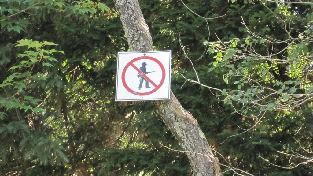
I found our way but instead of taking hwy 518 to Sequin Falls I wanted to take Sequin Trail which looks as a normal road on Google Maps. I turned on it but saw the sign right in the trees:
http://i397.photobucket.com/albums/pp53/scanner_d/Nipissing%20Road/NR-018.jpg
Ok, I wasn’t going to break any rules and had to stick to the plan and take 518. In 15 minutes we have entered Nipissing Road again heading to Sequin Falls. We stopped on Nipissing Road and Seguin trail intersection to take a look at the map
http://i397.photobucket.com/albums/pp53/scanner_d/Nipissing%20Road/NR-015.jpg
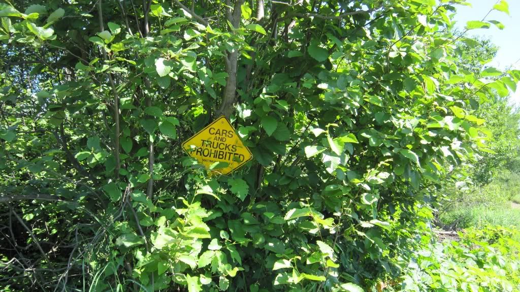
and took a little walk around Seguin Falls. We walked a little bit on Sequin trail, there was signs explicitly prohibiting cars and trucks and some other saying that there is a vehicle barrier ahead. We spotted some abandoned houses,
http://i397.photobucket.com/albums/pp53/scanner_d/Nipissing%20Road/NR-016.jpg
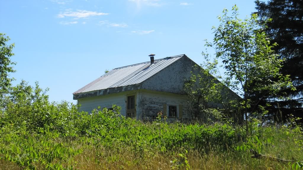
but there were on private property and it was many “No trespassing” and “Private Property” signs. I guess that people who live in Sequin Falls are not very happy with explorers. Although we didn’t see any people of traffic there most of the homes looked far from abandoned. There were parked cars, some landscaping around them , so to me Seguin Falls doesn’t looks like a ghost town at all.
http://i397.photobucket.com/albums/pp53/scanner_d/Nipissing%20Road/NR-017.jpg
So after a little walk and taking some pictures we drove south on Nipissing Road just to make sure that we didn’t miss anything. There was quite nice views but according the map the road ends in the bush and it was already 11:30am
http://i397.photobucket.com/albums/pp53/scanner_d/Nipissing%20Road/NR-019.jpg
We turned around, slowly drove through Sequin Falls, crossed 518 and entered Nipissing Road once again. I guess you can’t really walk with long gun there:
http://i397.photobucket.com/albums/pp53/scanner_d/Nipissing%20Road/NR-020.jpg
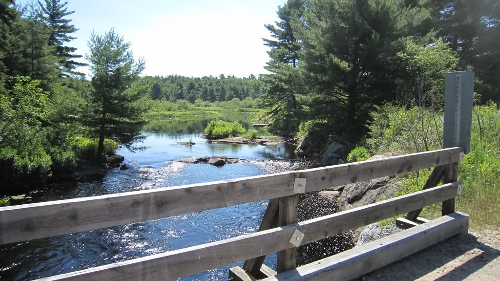
We saw few cemeteries – they all have a fence around so we could get any closer. There was only one cemetery at Dufferin Bridge, probably we should have taken a walk around there to find out any old building remains. Or take a detour to Dufferin Bridge rd. Maybe next time. We saw one cemetery at Spence, same thing as Dufferin Bridge. No visible from the road ghost towns.
http://i397.photobucket.com/albums/pp53/scanner_d/Nipissing%20Road/NR-022.jpg
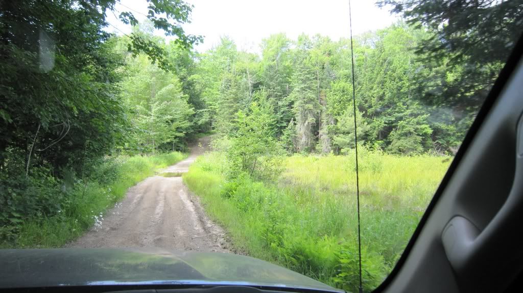
There was nice views along the road though.
http://i397.photobucket.com/albums/pp53/scanner_d/Nipissing%20Road/NR-023.jpg
http://i397.photobucket.com/albums/pp53/scanner_d/Nipissing%20Road/NR-024.jpg
http://i397.photobucket.com/albums/pp53/scanner_d/Nipissing%20Road/NR-028.jpg
I was looking at General store in Port Anson and nearly missed Midlothian road, really saw the sign last minute and had to make a sharp turn to Midlothian. It’s a gravel road but gravel really looks like a hard surface except on road turns where it’s a loose gravel.
Apparently gun control are not that strict in Nipissing area:
http://i397.photobucket.com/albums/pp53/scanner_d/Nipissing%20Road/NR-029.jpg
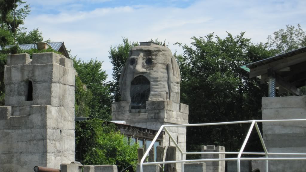
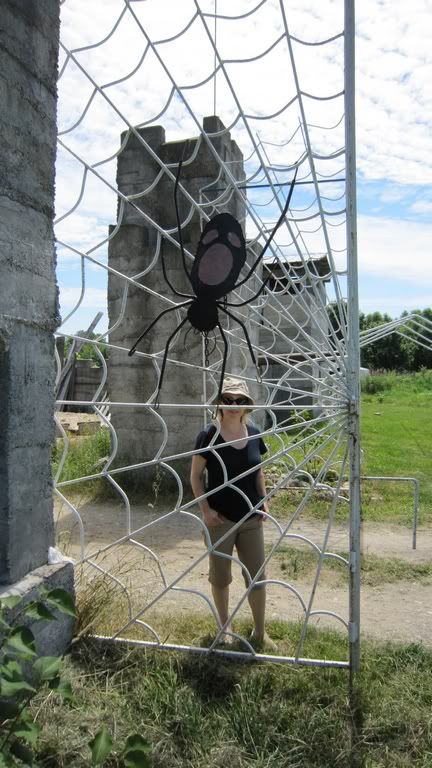
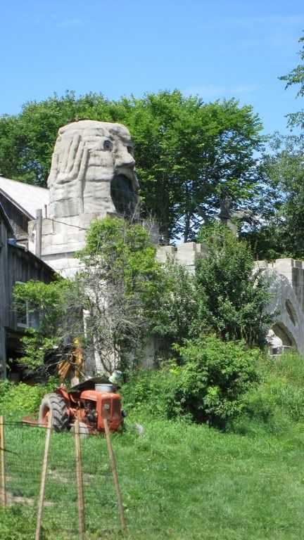
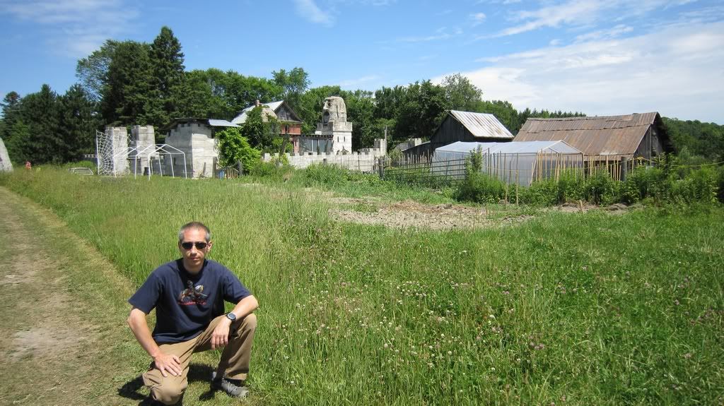
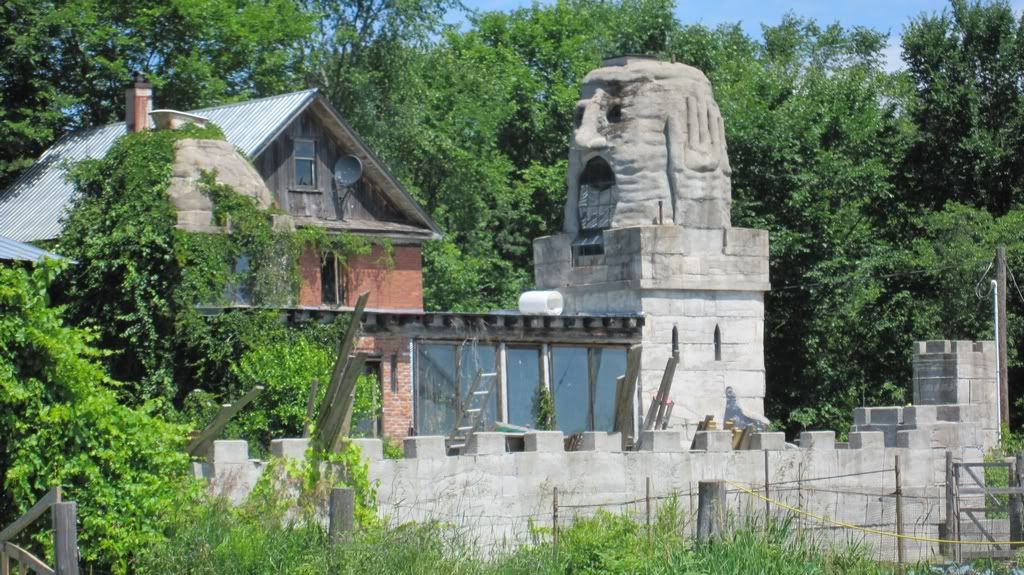
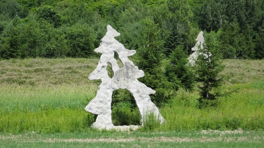
Anyway in about 10 min we were at Midlothian castle. There were no place to park along the road so with some hesitation I turned on the castle driveway. There were no any signs except something looking like a plastic barrel with sign saying that screaming heads t-shirts sells for $20 if I remember correctly. I pulled next to a pickup truck, the castle gate were open with some people inside. We thought that they were probably owners so we asked it we could look around. The owners were very friendly and they told us to feel free to go around and take pictures.
So we did.
http://i397.photobucket.com/albums/pp53/scanner_d/Nipissing%20Road/NR-030.jpg
http://i397.photobucket.com/albums/pp53/scanner_d/Nipissing%20Road/NR-032.jpg
http://i397.photobucket.com/albums/pp53/scanner_d/Nipissing%20Road/NR-033.jpg
http://i397.photobucket.com/albums/pp53/scanner_d/Nipissing%20Road/NR-038.jpg
http://i397.photobucket.com/albums/pp53/scanner_d/Nipissing%20Road/NR-039.jpg
http://i397.photobucket.com/albums/pp53/scanner_d/Nipissing%20Road/NR-040.jpg
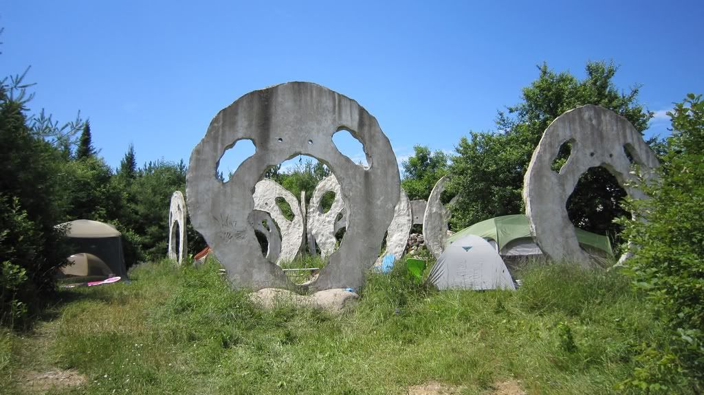
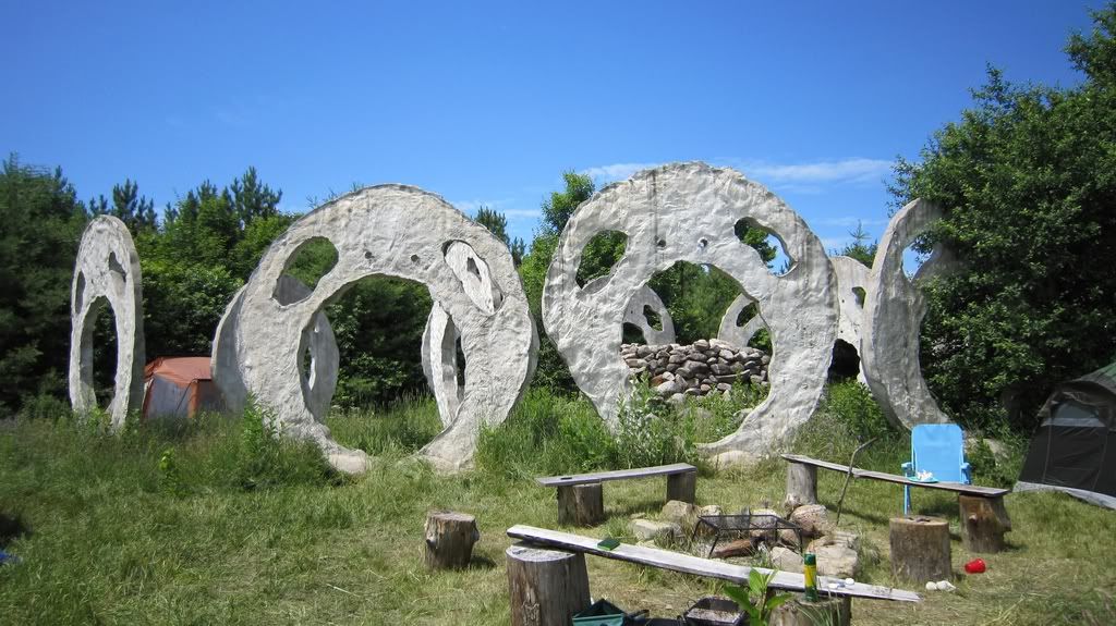
Screaming Heads are located on both sides on Midlothian road, on the Castle side there was even some campsite right between the heads
http://i397.photobucket.com/albums/pp53/scanner_d/Nipissing%20Road/NR-034.jpg
http://i397.photobucket.com/albums/pp53/scanner_d/Nipissing%20Road/NR-035.jpg
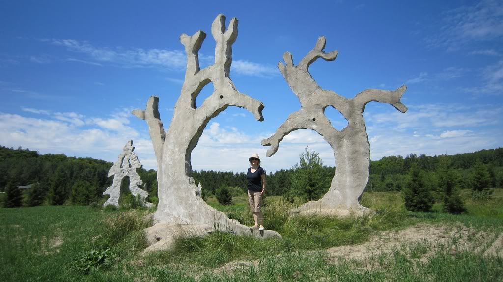
The field on the other side of the road had Screaming Heads I saw on the Internet:
http://i397.photobucket.com/albums/pp53/scanner_d/Nipissing%20Road/NR-041.jpg
http://i397.photobucket.com/albums/pp53/scanner_d/Nipissing%20Road/NR-042.jpg
http://i397.photobucket.com/albums/pp53/scanner_d/Nipissing%20Road/NR-043.jpg
Definitely was worth to take a detour. We would probably spend more time at the Heads but it was getting really hot and it was lunch time already and we were going to have a lunch on Eagle Lake. Looks like it’s not that far but still we had to get there .
I’d say that I should have planed this better and had a lunch in Magnetawan which looks very clean with white homes- leaves very nice impression. I wish we spent more time there but as I said we planned to have a lunch at the lake and we were ready for some swimming. Now looking at GPX tracks I think I should have planned one full day to explore section from Rosseau to Magnetawan exploring all side roads and walking around historic sites. Well, probably next time.
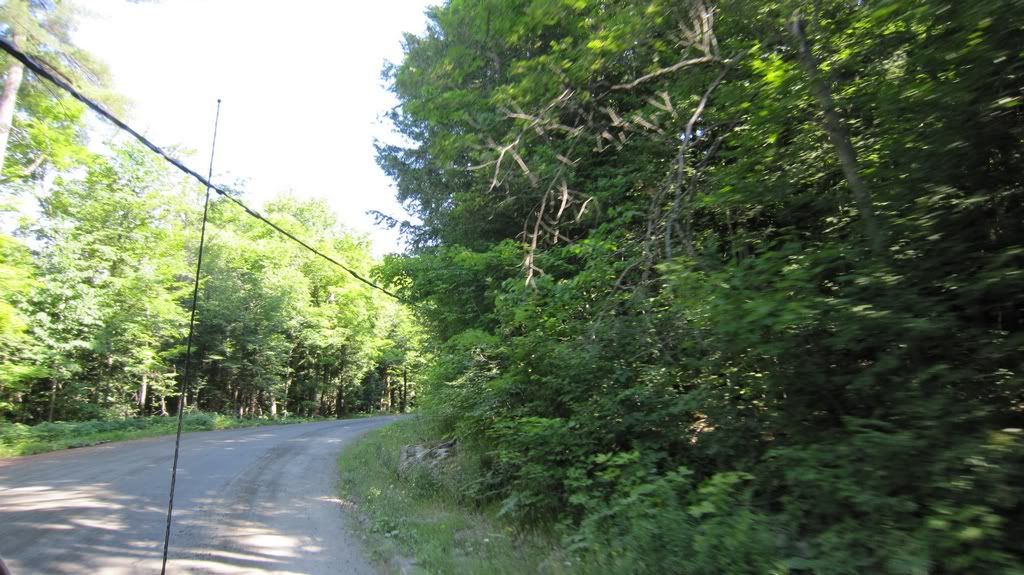
So we were heading north on Nipissing Road
http://i397.photobucket.com/albums/pp53/scanner_d/Nipissing%20Road/NR-045.jpg
and I asked my wife to tell me direction using the map I printed out from http://images.ourontario.ca/Almaguin/68642/image/161215 Shortest way to the Eagle Lake was to take a detour at Pond Rd, and we were planning to spend some time on the lake, then return back and complete our trip. Driving on Nipissing road
http://i397.photobucket.com/albums/pp53/scanner_d/Nipissing%20Road/NR-046.jpg
we have reached a fork which has handwritten sigh saying that there is Youthdale Rd on the left and Nipissing Rd continues on the right. Youthdale Rd looked like a logical extension of Nipissing road, and Nipissing Road arrow pointed to rocky narrow trail leading uphill.
http://i397.photobucket.com/albums/pp53/scanner_d/Nipissing%20Road/NR-047.jpg
(by the way it looks way more friendly on the picture)
Although my wife started showing signs of worrying, so far it wasn’t something my truck can’t drive through. I turned on low gear just in case and we went up the road. Which wasn’t really a road but a very uneven 4×4 trail. After I climbed the hill I saw that I don’t really need a low gear, it probably doable in 2WD with good tires and high clearance. High clearance is a must, a car won’t make it in one piece.
http://i397.photobucket.com/albums/pp53/scanner_d/Nipissing%20Road/NR-048.jpg
http://i397.photobucket.com/albums/pp53/scanner_d/Nipissing%20Road/NR-049.jpg
http://i397.photobucket.com/albums/pp53/scanner_d/Nipissing%20Road/NR-050.jpg
After awhile we turned on Pond road which is an offroad trail too.
http://i397.photobucket.com/albums/pp53/scanner_d/Nipissing%20Road/NR-052.jpg
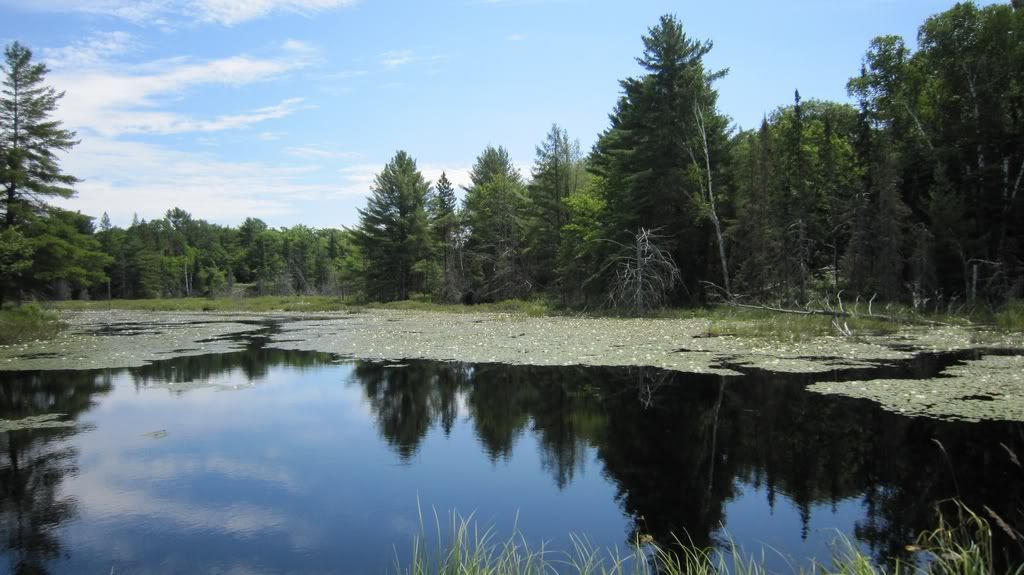
After 3 km we came out of forest on the normal gravel road – Miller rd. We drove right to Eagle Lake but we were unable to find any public beach or picnic site. The lake seems to be surrounded by private cottages. There were no people to ask in sight but after some time we found Mikisew Provincial park. The girl at the counter told us that 1 hr in the park is free, we left deposit $11 in exchange to 1 hour park permit. The girl told us that if we back in 1 hr she’d give us deposit back. Needless to say it was 2:20pm, and we wanted to have a lunch. Picnic tables in public area were not very close to the lake but quite close to parking. We had all camping stuff with us, so we cooked some lunch on camping stove and were back to the park gate in 50 mins.
On our way back I couldn’t rely on GPS because it has no regards of our exploring plans – it just gets fastest route. So we used paper maps and got lost. The most confusing part was that Old Nipissing Road on some part of it calls Rye Rd and Jerusalem Rd. And name “Old Nipissing Road” in not in the GPS at all. Looking at GPS track now I see that I just took wrong turn heading off the Provincial Park. It wasn’t so obvious on the road though. I’ve never been good with directions and I guess I started to suspect that we have not enough time to complete trip as planned which didn’t make me any better : )
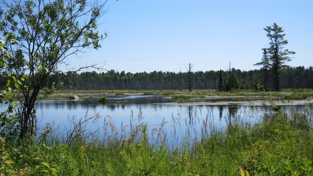
After awhile my wife found an intersection to set GPS to Eagle Lake rd and Rye Rd. And GPS got us there. I turn north to Commanda from there and as I result completely missed Boomers Roost. Which I thought has to an interesting place providing that road there is not widely accessible. Oh well, something for next time perhaps. So we were driving up the Old Nipissing Road again which was Rye Road on the map and just a Nipissing Road on GPS. It’s a narrow road with forest around it, lakes, some swamps, abandoned farms and private houses. Black flies were buzzing around and we didn’t want to leave the truck for some exploring.
http://i397.photobucket.com/albums/pp53/scanner_d/Nipissing%20Road/NR-053.jpg
There are Forgotten trail signs along the road and big sign that Bridge on Jerusalem Road is closed. If we had more time I would drive to the bridge to check it out, maybe I don’t even need a bridge. But it was around 5pm and we needed to get at least to Commanda museum when we were so close. When we have reached Rye road became bumpy and narrower but still passable but a car. I expected to see some buildings in Rye but saw a sign for Post office
http://i397.photobucket.com/albums/pp53/scanner_d/Nipissing%20Road/NR-054.jpg
and similar sign for Church. Hmm, looks like we came too late.
Shorty after Rye road got narrowed and rockier, but still OK.
http://i397.photobucket.com/albums/pp53/scanner_d/Nipissing%20Road/NR-055.jpg
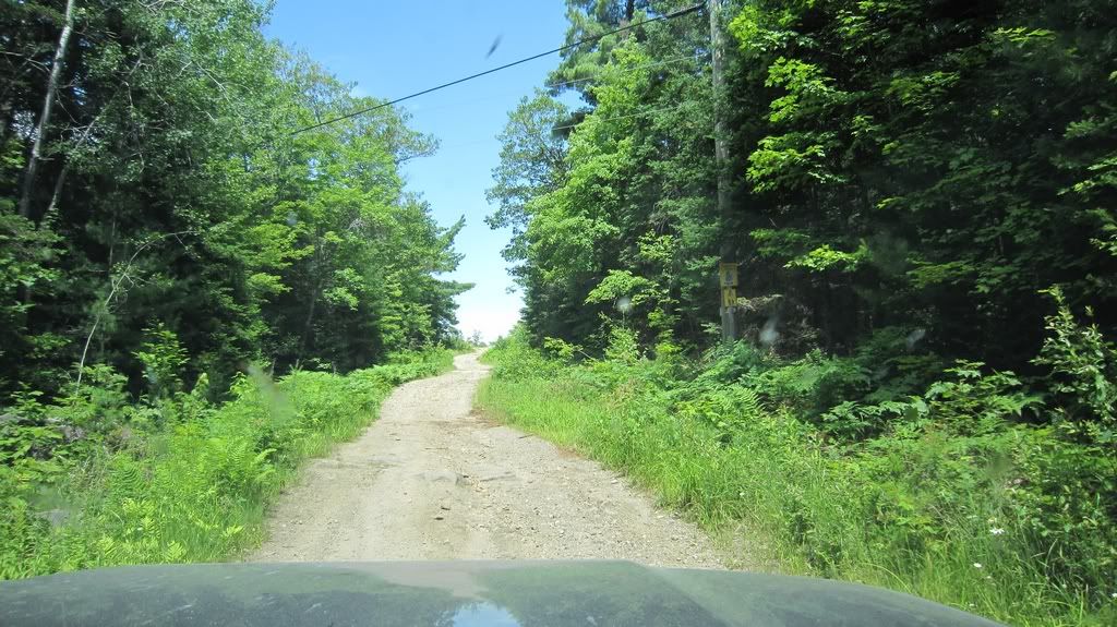
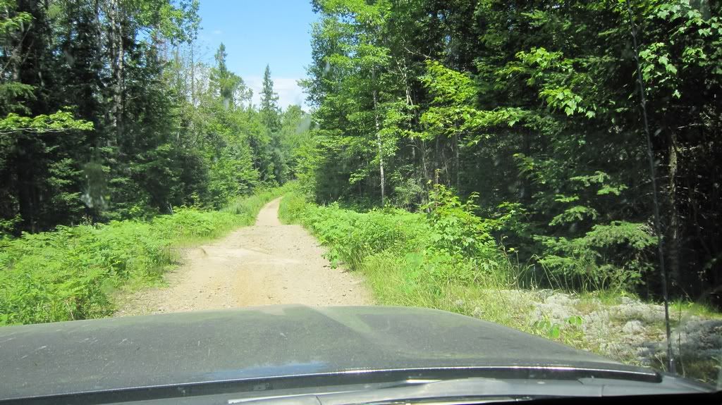
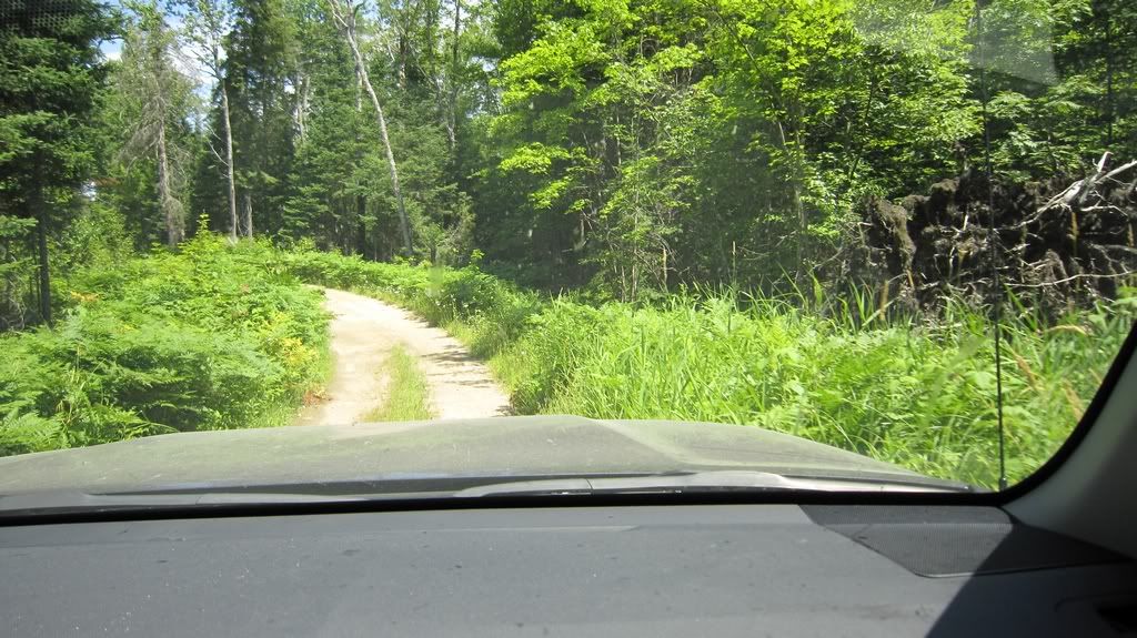
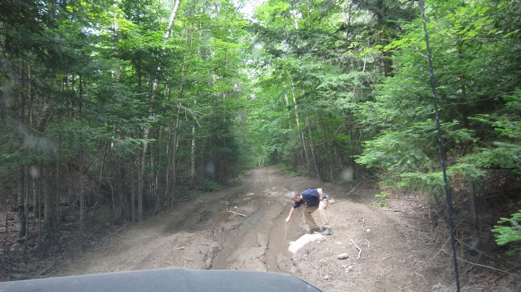
Initially my plan was to turn on Jerusalem Road, but since bridge was closed I drove straight to Old Nipissing Road which is not on google maps or my GPS. it’s showed in Backroads Map as a trail though. Its narrow trail obviously hasn’t been maintained for long time. Bumpy and rocky with some ruts, so we could move at about 10 km/h.
http://i397.photobucket.com/albums/pp53/scanner_d/Nipissing%20Road/NR-056.jpg
But a real pioneer road, real adventure and probably since Jerusalem road is out of question because of closed bridge we would get to Commanda faster then going all the way back via Eagle Lake road. First sign of trouble was this puddle:
http://i397.photobucket.com/albums/pp53/scanner_d/Nipissing%20Road/NR-057.jpg
a small one, really nothing to worry about. Still surprised I saw a water on the road after many day of hot weather. I even measure how deep is it making sure that it won’t swallow front wheels. Who knows, people said that road might be impassable : )
http://i397.photobucket.com/albums/pp53/scanner_d/Nipissing%20Road/NR-058.jpg
(I moved fast because of black flies)
Not that deep really. And road goes uphill anyway. And became even narrower with trees closing by. Oh well, few scratches seems to be unavoidable but I got a truck after all, and I want to use it, not just having it clean and sparkling on driveway. So we continued our trip though the forest. Unfortunately there were so many black flies we couldn’t even open windows.
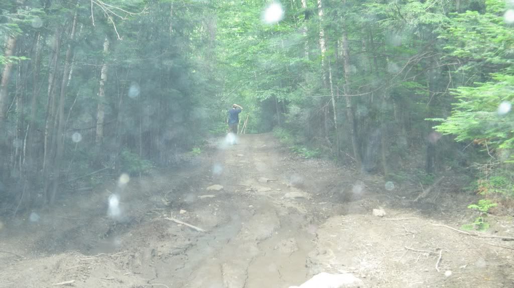
Then we saw a little bit of mud on the trail. Then some more. This mud pit I measured was about 6 inches deep –
http://i397.photobucket.com/albums/pp53/scanner_d/Nipissing%20Road/NR-059.jpg
we drove over it with no troubles and next one was wider and deeper. Then I hit another one and road seemed to run uphill. I went out to see what is over the hill
http://i397.photobucket.com/albums/pp53/scanner_d/Nipissing%20Road/NR-060.jpg
and saw that road goes downhill from that point and there are some more mud. At this point I thought that we still might be able to make it through, but travelling any further alone with my stock H/T tires and without a winch was not a good idea. I got a feeling that mud ahead could be deeper and if we stuck there CAA would not come to get us out. After all this part of Nipissing Road isn’t on the road map and we have 5 km to walk surrounded by black flies to nearest populated place. Still an adventure, but I don’t think a nice one. My wife didn’t complain and didn’t ask me turn back although I had a feeling that she wouldn’t be happy if we stuck in the middle of the trail. As a last resort I had a shovel and box of old 2x4s I was going to burn on campfire but could put under wheels if I stuck. Was not looking forward for it though. So I decided to turn back and take less questionable roads to Commanda. It wasn’t easy to turn around on narrow road, but after awhile we were driving back.
http://i397.photobucket.com/albums/pp53/scanner_d/Nipissing%20Road/NR-061.jpg
Rear parking sensors and camera really saved some trees or my read bumper (didn’t test which one is stronger). Barely made last mud pit by the way, I guess mud became thinner and more slippery after I drove over it first time.
I guess it was very dry July so far but I didn’t’ get to the point when I say that Old Nipissing road is impassable. I turned around when it was 5 km to Commanda and I’d say it was risky but doable in a good vehicle. If not mud I wouldn’t be worried much about passing it.
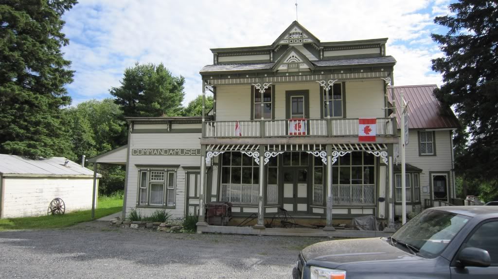
To my surprise Commanda was listed in my GPS and we got there without any surprises. But a little bit late, the Commanda Museum was already closed.
http://i397.photobucket.com/albums/pp53/scanner_d/Nipissing%20Road/NR-063.jpg
It appeared that it’s open from 9am to 4 pm.
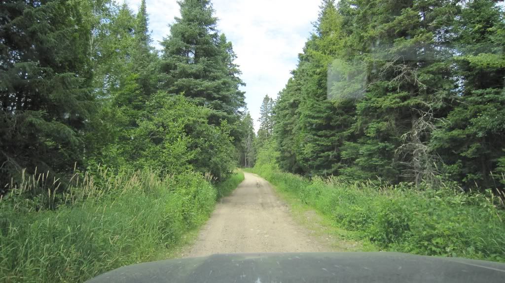
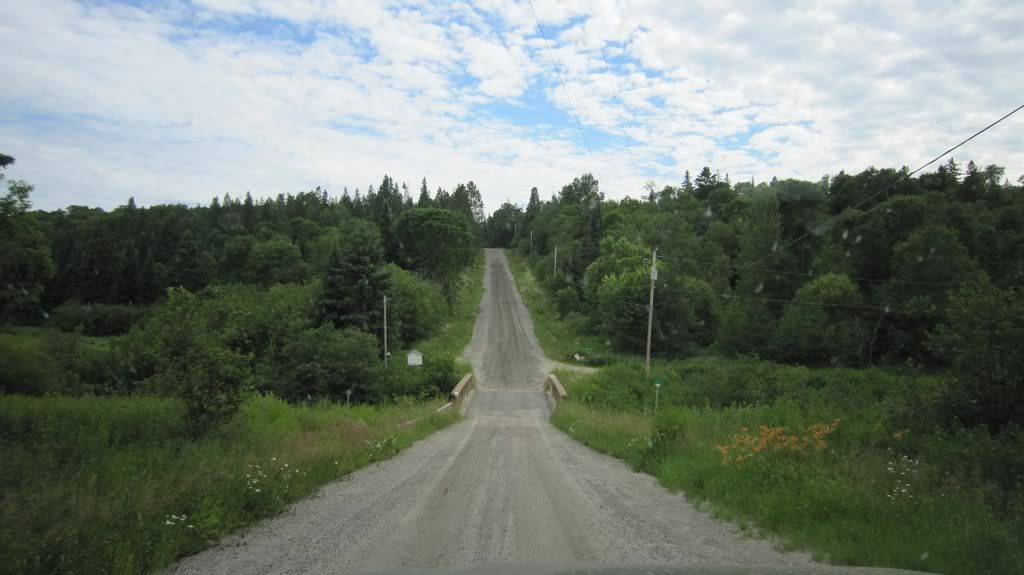
It was around 5pm and it looked that we didn’t have time to drive to Nipissing, so I put our camping site coordinates in GPS and start moving there. GPS got us back to Nipissing road which is nice gravel road at that point:
http://i397.photobucket.com/albums/pp53/scanner_d/Nipissing%20Road/NR-064.jpg
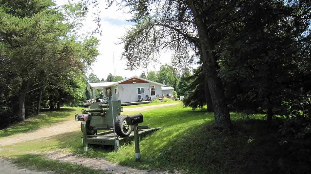
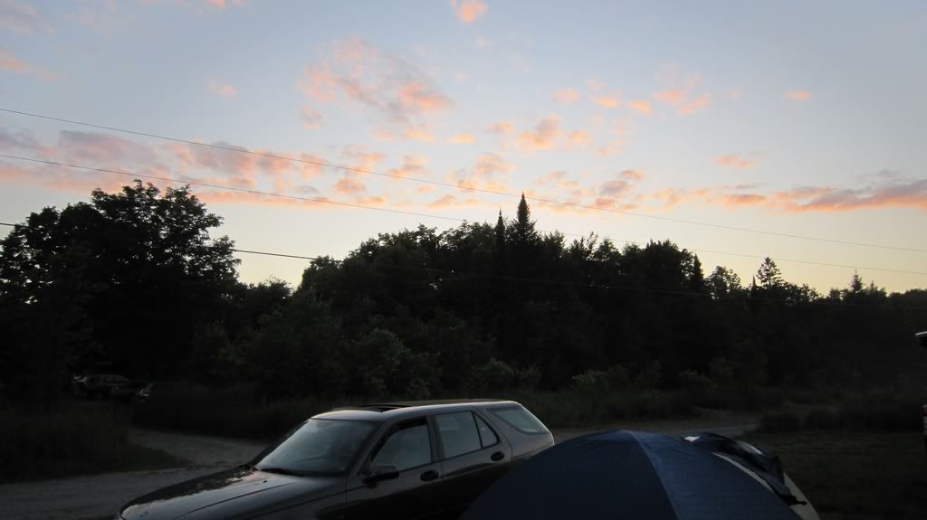
but then I missed the turn and GPS obviously was trying to put us trough some rough roads with was ok with me, but me wife was afraid that we would be too slow and won’t make it before dark. As a result we got to hwy 522 and drove to the campsite on the pavement. In about 2 hrs we were at the campsite and watched sunset fully relaxed:
http://i397.photobucket.com/albums/pp53/scanner_d/Nipissing%20Road/NR-065.jpg
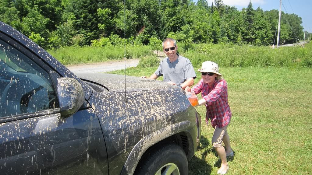
Our friends were impressed by how much dirt was on my truck made us pretend we push it out of trouble next morning.
http://i397.photobucket.com/albums/pp53/scanner_d/Nipissing%20Road/NR-066.jpg
What matters is that after all my wife was happy with our little adventure.
http://i397.photobucket.com/albums/pp53/scanner_d/Nipissing%20Road/NR-067.jpg
So Lessons learned:
The trip needed to be at least 2 days if you want to explore everything there. Needed to take in consideration that speed might drop down to 10 km/h for quite some time.
The final night stay is better to be around last point of the trip, our was somewhere closer to trip start.
Everything on the road is different to what is on the map, with all maps and GPS I can still loose my direction and go off the planned route.
I definitely needed to plan better comparing maps and probably create waypoints on GPS.
Although I would hate to throw away tires with 20,000 km on them I’ll bite the bullet and buy some A/T tires before winter. Firestone Destination is what I keep in mind.
I don’t want to cut into truck which is still on warranty, I guess I need to buy a hand winch.
It safer to drive on road which became a trail in a convoy.
In the middle of July black flies are still bad enough to be on outside in deep forest.
Should have driven on Jerusalem Road and see that bridge.
And there is some points in the conclusion:
It was interesting experience, I got a feeling of Nipissing Road and want to make more trips like this.
I have deep respect for Pioneers, it’s amazing how they managed to develop that area and build such a beautiful country for us.
We saw few historical sites, and although it wasn’t as many I expected it still was good.
Screaming Heads was definitely worth to see.
I put my truck on test and it passed test with high marks.
The trip like this clears up my head – it nice to be disconnected from civilization for a weekend. I wish I had more than a weekend and less civilization though.
http://eseliv.byethost7.com/nr/Rosseau-to-Commanda-July16-2011.gpx